Weather Summary for 27 May 2001
The dominant synoptic features were a weak high-pressure ridge across central Florida south of a weak boundary from central Georgia to Alabama.![Weather Summary Image 2](https://kscweather.ksc.nasa.gov/abfm/files/ABFM/webpage\june2001\Weather_Summ\2001_05_27_files\image002.jpg)
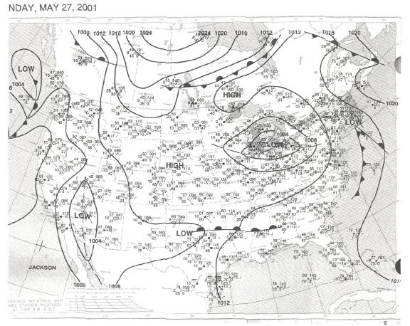
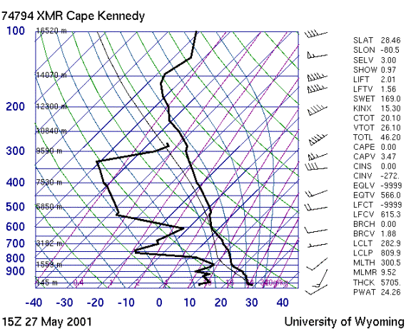
The sounding shows a dry, stable day with substantial speed shear in the middle troposphere.
![Weather Summary Image 4](https://kscweather.ksc.nasa.gov/abfm/files/ABFM/webpage\june2001\Weather_Summ\2001_05_27_files\image004.gif)
![Weather Summary Image 5](https://kscweather.ksc.nasa.gov/abfm/files/ABFM/webpage\june2001\Weather_Summ\2001_05_27_files\image005.gif)
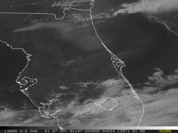
Active convection was restricted to the southern third of the Florida Peninsula, with most of the activity between Lake Okeechobee and the east coast.
![Weather Summary Image 7](https://kscweather.ksc.nasa.gov/abfm/files/ABFM/webpage\june2001\Weather_Summ\2001_05_27_files\image007.gif)