Weather Summary for 20 Jun 2000
Weak high-pressure with light gradients characterized the surface pressure filed over Florida.![Weather Summary Image 2](https://kscweather.ksc.nasa.gov/abfm/files/ABFM/webpage\june2000\Weather_Summ\2000_06_20_files\image002.jpg)
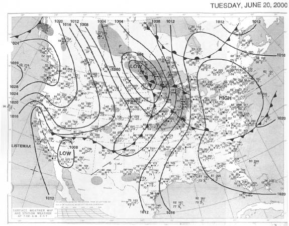
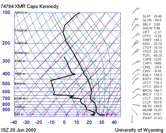
Winds were light from a general southeasterly direction near the surface becoming northeast above 800 mb. The sounding shows a very dry and somewhat stable air mass.
![Weather Summary Image 4](https://kscweather.ksc.nasa.gov/abfm/files/ABFM/webpage\june2000\Weather_Summ\2000_06_20_files\image004.gif)
![Weather Summary Image 5](https://kscweather.ksc.nasa.gov/abfm/files/ABFM/webpage\june2000\Weather_Summ\2000_06_20_files\image005.gif)
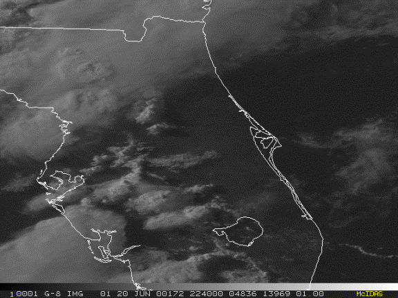
No storms formed near Cape Canaveral. The closest convection formed along the east coast sea breeze well inland with weak storms near Orlando at 1930Z. There was also activity west of a Lake Okeechobee Orlando line.
![Weather Summary Image 7](https://kscweather.ksc.nasa.gov/abfm/files/ABFM/webpage\june2000\Weather_Summ\2000_06_20_files\image007.gif)