Weather Summary for 12 Jun 2000
A broad ridge of high pressure extending from the Atlantic Ocean across northern Florida and the Gulf states as presented in the surface chart provided light gradients and little synoptic forcing.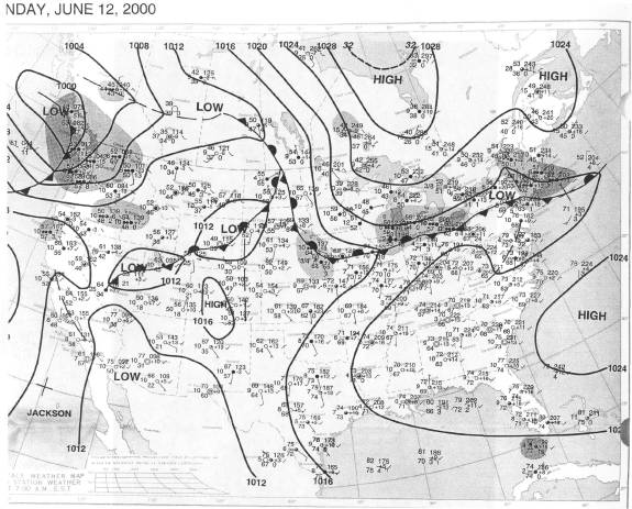
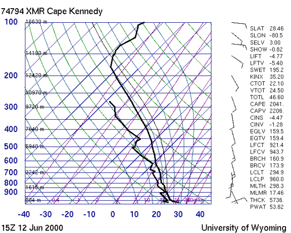
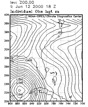
The sounding shows that the airmass was unstable due to deep tropical moisture, possible left over from a tropical wave that passed through central Florida on 11 June. There was little wind shear, and the 200 mb chart shows that the upper level low pressure area previously near northwestern Cuba had moved further west, weakening the gradient aloft. This resulted in light and variable anvil level winds.
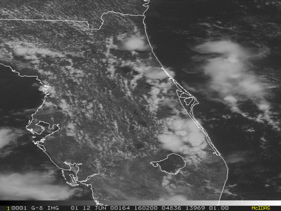
Storms formed along the east coast seabreeze near 16Z south of the Cape.