Weather Summary for 7 Jun 2000
A cold front extended across central Florida producing weak offshore low level flow near the Cape as shown in the surface chart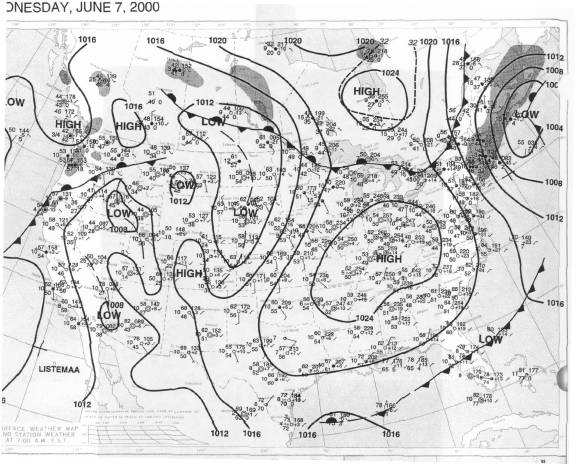
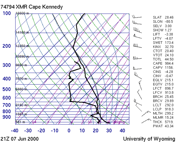
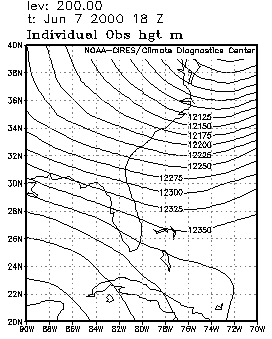
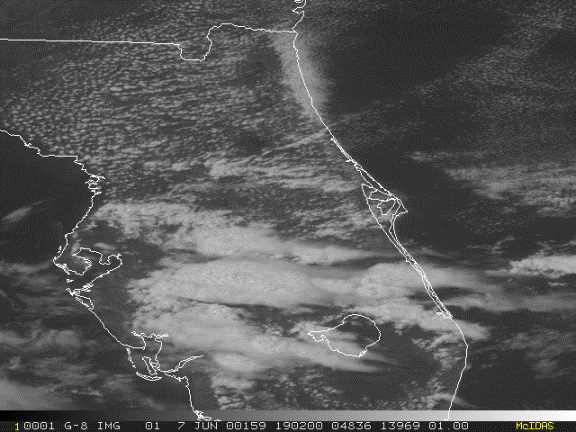
The air mass in the vicinity of the frontal boundary was moderately unstable as shown in the sounding. The upper level flow was from the northwest as shown in the sounding and the 200 mb chart. Storms with long anvils formed north of Tampa as well as south and west of Melbourne before 18Z along the seabreeze convergence lines. The anvils from storms on both coasts streamed out toward the east-southeast as shown in the visible satellite image. As the west coast seabreeze (WCSB) moved inland, its anvils merged with those from ECSB storms.