Synthesis for June 24, 2001

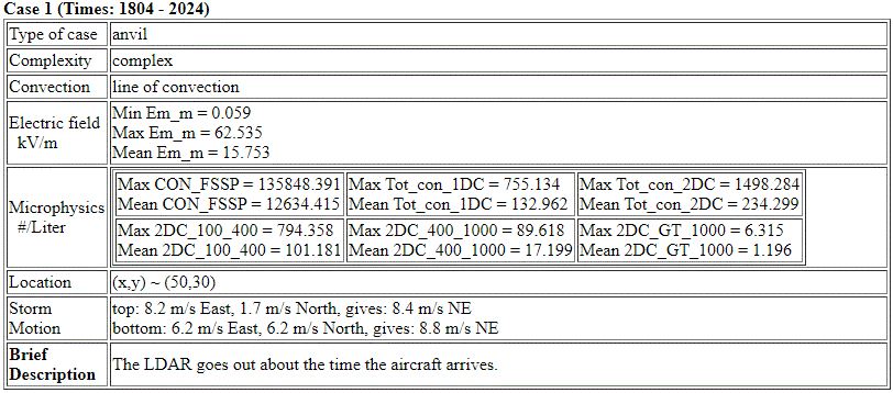
The convective line is in an arc shape where the top of the arc and the bottom of the arc do not move in the same way.
Summary for June 24, 2001
Investigator: (Frank Merceret)
SUMMARY by Frank Merceret
The citation performed NE/SW racetracks at an altitude of about 9 Km from 18:00 to 20:30Z in a region of highly electrified anvil just east of Cape Canaveral. This anvil was associated with a thunderstorm complex that produced severe weather throughout Brevard County, including a tornado at KSC. Heavy rain from the system fell on the WSR-74C resulting in strong attenuation due to radome wetting, so WSR-88D data is used for the analysis. While in-cloud (as well as surface) fields were high throughout the period, there were cases of cloud entry and exit that may be useful for analysis of field decay with distance from cloud edge. There were also indications of penetration through or near charge centers or screening layers. High fields were always associated with box-averaged radar reflectivities > 5 dBz.
24 June 2001 Weather Overview
24 June 2001 ABFM Operations Summary
Initial Analysis Summary 24June01


