


Synthesis for June 23, 2000
Flight Summary: Flight 2 Ferry Flight (Non-Anvil Day)
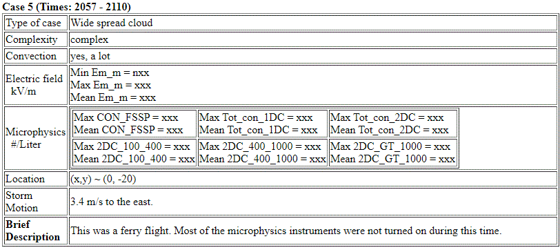
The storms on this day were a complex of convection that moved in from the west. At end of flight 1, the aircraft had to land at Vero Beach and wait for the lightning to stop over PAFB. The return Ferry Flight was at low altitude through stratiform precipitation.
The "Storm Motion" calculations are very rough estimates.
Summary for June 23, 2000
Investigator: (None)
The following summary is from the notes that Jim Dye and Eric Defer put together. Probably early in 2001 (before the May/June 2001 Field Campaign).
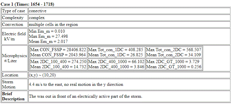
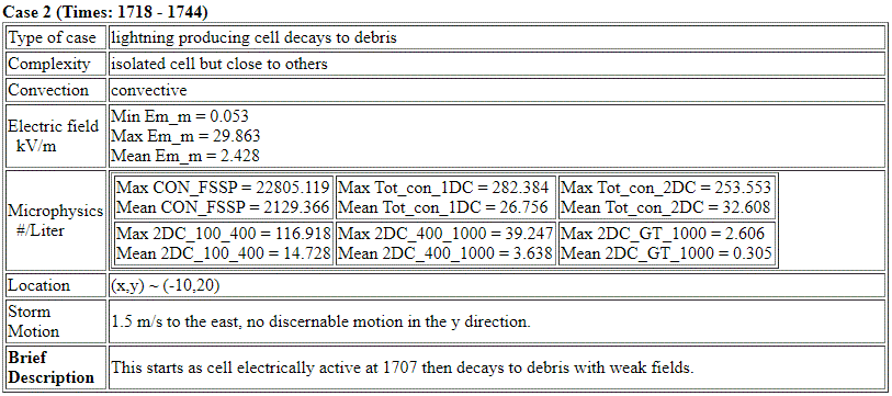
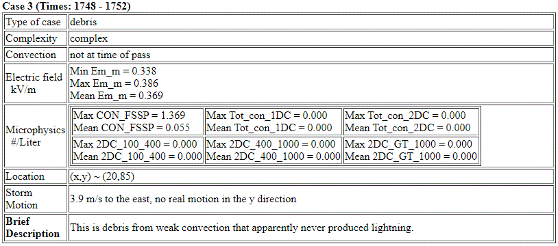
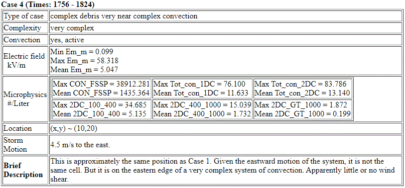
E fields reported in the summaries below are based on the old matrix for determination of the three components of the field. The new matrix provided in April 2001 reduces the negative values of Ez as much as 40 to 60%. So the values reported herein may be too large. Positions are reported herein as (X,Y) coordinates relative to the WSR74-C radar.
The total concentrations of particles measured by the 2D-C probe are denoted as N30 (ie. concentration of particles >30 microns which is heavily weighted towards smaller particles). N1 refers to the concentration of particles >1mm size, ie. the larger particles. Radar plots were available for only a few of the last summaries we prepared (June 4, 6, and 11). For other days some of the realtime radar plots were utilized but need to be verified.
June 23
Flight from 1636 to 1910 made a few passes at 7.6 km in 2 decaying thunderstorms north of KSC and then flew in and near active cells while trying to land at Patrick AFB before diverting to Vero Beach. E field of +25 to –40 KV/m with large horizontal variations. The aircraft followed the E field decay to ~5 KV/m before the weak anvil disappeared.